Fair Areas: Difference between revisions
Public wiki for the 1904 Louisiana Purchase Exposition
No edit summary |
No edit summary |
||
| Line 1: | Line 1: | ||
__NOTOC__ | __NOTOC__ | ||
{{#tag:imagemap| | {{#tag:imagemap| | ||
Image:Fair Areas {{!}}{{{1|100%}}} | Image:Fair Areas.jpg {{!}}{{{1|100%}}} | ||
poly 165 629 331 628 164 529 71 362 47 386 46 450 112 560 [[Model City|Model City]] | poly 165 629 331 628 164 529 71 362 47 386 46 450 112 560 [[Model City|Model City]] | ||
poly 170 632 629 722 [[The Pike|The Pike]] | poly 170 632 629 722 [[The Pike|The Pike]] | ||
Revision as of 23:08, 25 February 2024
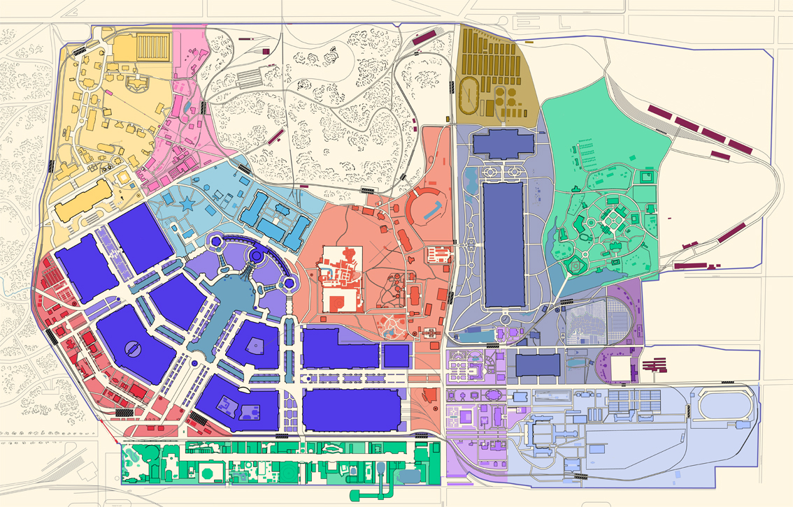
- Main Picture - The central portion of the fair, hosting the Palaces
- The Pike - A mile-long amusement lane, similar to a midway.
- Plateau of States - An elevated plateau, where many of the State buildings were built.
- Art Hill - Area including the Art Museum and attractions nearby.
- Place of Nations - Many international buildings were located here.
- Anthropology Area - Tribes of Native Americans were displayed in this area.
- Philippine Exhibit - The newly acquired Philippines were showcased here.
- Agriculture Area - Many outdoor exhibits based on farm life were hosted here.
- The Trail - A forested area with many attractions, and some state buildings.
- Mining Gulch - A natural valley filled with outdoor mining exhibits.
- Washington University - Contained many administration buildings, and attractions.
- Model City - A demonstration of urban planning.
- Support Buildings - The fair required many support structures to ensure operation.
- Livestock-Place where farm animals were