Maps: Difference between revisions
Public wiki for the 1904 Louisiana Purchase Exposition
No edit summary |
No edit summary |
||
| Line 16: | Line 16: | ||
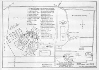
File:October 1902 Ground Plan.jpg | Final Ground Plan of 1902 | File:October 1902 Ground Plan.jpg | Final Ground Plan of 1902 | ||
</gallery> | </gallery> | ||
==1903== | ==1903== | ||
| Line 35: | Line 33: | ||
File:October 1904 Ground Plan.jpg | File:October 1904 Ground Plan.jpg | ||
</gallery> | </gallery> | ||
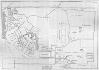
==1972== | ==1972== | ||
<gallery | class="center" | mode=packed-hover | widths=350px heights=150px>> | |||
File:1972-Lyle Maninger Map.jpg | |||
</gallery> | |||
==2023== | ==2023== | ||
<gallery | class="center" | mode=packed-hover | widths=350px heights=150px>> | |||
[[File:Flat_Full.jpg]] | [[File:Flat_Full.jpg]] | ||
[[File:Flat_Main.jpg]] | [[File:Flat_Main.jpg]] | ||
| Line 43: | Line 45: | ||
[[File:Satmap.jpg]] | [[File:Satmap.jpg]] | ||
[[File:Vintage.jpg]] | [[File:Vintage.jpg]] | ||
</gallery> | |||
[[Category:Maps]] | [[Category:Maps]] | ||
Revision as of 07:55, 17 March 2024
Maps of the Fair
1901
Gallery
-
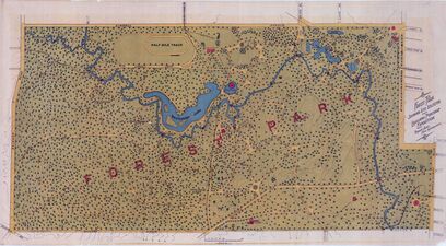
Map of Forest Park in 1901

1902
-
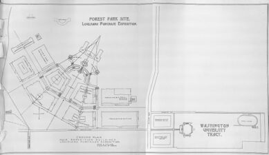
Early plan of fair showing the basic 'Fan' Design
-
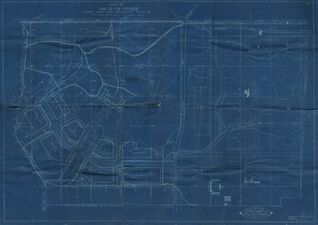
Blueprint of the fair, showing rough building placements
-
Revised ground plan of September 1902
-
Final Ground Plan of 1902


