Loading map...
{"minzoom":2,"maxzoom":7,"mappingservice":"leaflet","width":"auto","height":"350px","centre":false,"title":"","label":"","icon":"","lines":[],"polygons":[],"circles":[],"rectangles":[],"copycoords":true,"static":false,"zoom":3,"defzoom":14,"layers":["OpenStreetMap"],"image layers":["Flat City.jpg"],"overlays":[],"resizable":false,"fullscreen":true,"scrollwheelzoom":true,"cluster":true,"clustermaxzoom":20,"clusterzoomonclick":true,"clustermaxradius":80,"clusterspiderfy":true,"geojson":{"type":"FeatureCollection","features":[{"type":"Feature","properties":{"title":"Government Restaurant","description":""},"geometry":{"type":"Point","coordinates":[13.875,80.1875]}},{"type":"Feature","properties":{"title":"Liquid Air Exhibit","description":""},"geometry":{"type":"Point","coordinates":[10.9375,66.625]}},{"type":"Feature","properties":{"title":"Bathroom","description":""},"geometry":{"type":"Point","coordinates":[15.15625,60.40625]}},{"type":"Feature","properties":{"title":"Press Building","description":""},"geometry":{"type":"Point","coordinates":[20.6875,59.375]}},{"type":"Feature","properties":{"title":"Police Station","description":""},"geometry":{"type":"Point","coordinates":[16.90625,57.4375]}},{"type":"Feature","properties":{"title":"Voney's","description":""},"geometry":{"type":"Point","coordinates":[14.390625,56.3125]}},{"type":"Feature","properties":{"title":"Behnke \u0026 Willmann Restaurant","description":""},"geometry":{"type":"Point","coordinates":[17.625,62.3125]}},{"type":"Feature","properties":{"title":"DeForrest Wireless Tower","description":""},"geometry":{"type":"Point","coordinates":[19.25,52.765625]}},{"type":"Feature","properties":{"title":"Emergency Hospital","description":""},"geometry":{"type":"Point","coordinates":[23.203125,47.4375]}},{"type":"Feature","properties":{"title":"Automobile Charging Station","description":""},"geometry":{"type":"Point","coordinates":[24.984375,41.75]}},{"type":"Feature","properties":{"title":"Fleischmann Restaurant","description":""},"geometry":{"type":"Point","coordinates":[30.609375,49.96875]}},{"type":"Feature","properties":{"title":"Rice Kitchen","description":""},"geometry":{"type":"Point","coordinates":[32.421875,45.703125]}},{"type":"Feature","properties":{"title":"Drug Store","description":""},"geometry":{"type":"Point","coordinates":[34.859375,42.859375]}},{"type":"Feature","properties":{"title":"Model Playground","description":""},"geometry":{"type":"Point","coordinates":[28.921875,37.5625]}},{"type":"Feature","properties":{"title":"New Jersey Road Exhibit","description":""},"geometry":{"type":"Point","coordinates":[32.640625,33.5]}},{"type":"Feature","properties":{"title":"Town Hall","description":""},"geometry":{"type":"Point","coordinates":[38.34375,35.4375]}},{"type":"Feature","properties":{"title":"St Paul and Minneapolis","description":""},"geometry":{"type":"Point","coordinates":[41.625,32.921875]}},{"type":"Feature","properties":{"title":"Kansas City Casino","description":""},"geometry":{"type":"Point","coordinates":[45.25,30.6875]}},{"type":"Feature","properties":{"title":"Guild Hall","description":""},"geometry":{"type":"Point","coordinates":[37.28125,27.9375]}},{"type":"Feature","properties":{"title":"San Francisco","description":""},"geometry":{"type":"Point","coordinates":[39.84375,27.34375]}},{"type":"Feature","properties":{"title":"Bungalow Restaurant","description":""},"geometry":{"type":"Point","coordinates":[42.125,25.53125]}},{"type":"Feature","properties":{"title":"New York City","description":""},"geometry":{"type":"Point","coordinates":[45.03125,23.59375]}},{"type":"Feature","properties":{"title":"American Inn","description":""},"geometry":{"type":"Point","coordinates":[51.21875,28.40625]}},{"type":"Feature","properties":{"title":"Intramural Railway","description":""},"geometry":{"type":"Point","coordinates":[45.0625,19.3125]}},{"type":"Feature","properties":{"title":"Intramural Railway ","description":""},"geometry":{"type":"Point","coordinates":[75.46875,17.375]}},{"type":"Feature","properties":{"title":"Bathroom","description":""},"geometry":{"type":"Point","coordinates":[73.15625,15.0625]}},{"type":"Feature","properties":{"title":"Women's Anchorage Building","description":""},"geometry":{"type":"Point","coordinates":[79.0625,12.375]}},{"type":"Feature","properties":{"title":"Engine House","description":""},"geometry":{"type":"Point","coordinates":[75.78125,11.84375]}},{"type":"Feature","properties":{"title":"Official Photographer's Studio","description":""},"geometry":{"type":"Point","coordinates":[71.25,16.15625]}},{"type":"Feature","properties":{"title":"Express Office","description":""},"geometry":{"type":"Point","coordinates":[59.9375,13.5]}},{"type":"Feature","properties":{"title":"Bank","description":""},"geometry":{"type":"Point","coordinates":[56.0625,13.4375]}},{"type":"Feature","properties":{"title":"Parcel Checking Pavilion","description":""},"geometry":{"type":"Point","coordinates":[41.78125,8.46875]}},{"type":"Feature","properties":{"title":"US War and Field Hospital]","description":""},"geometry":{"type":"Point","coordinates":[20.03125,68.875]}},{"type":"Feature","properties":{"title":"Engine House","description":""},"geometry":{"type":"Point","coordinates":[12.9375,71.25]}},{"type":"Feature","properties":{"title":"BBQ","description":""},"geometry":{"type":"Point","coordinates":[25.09375,63.59375]}},{"type":"Feature","properties":{"title":"Septic System","description":""},"geometry":{"type":"Point","coordinates":[44.46875,34.03125]}},{"type":"Feature","properties":{"title":"Gas Building","description":""},"geometry":{"type":"Point","coordinates":[34.59375,24.1875]}}]},"clicktarget":"","GeoJsonSource":"ModelCity","GeoJsonRevisionId":4848,"imageLayers":[{"name":"Flat City.jpg","url":"/wiki/images/4/41/Flat_City.jpg","width":100,"height":99.5956873315363822030121809802949428558349609375}],"locations":[],"imageoverlays":null}
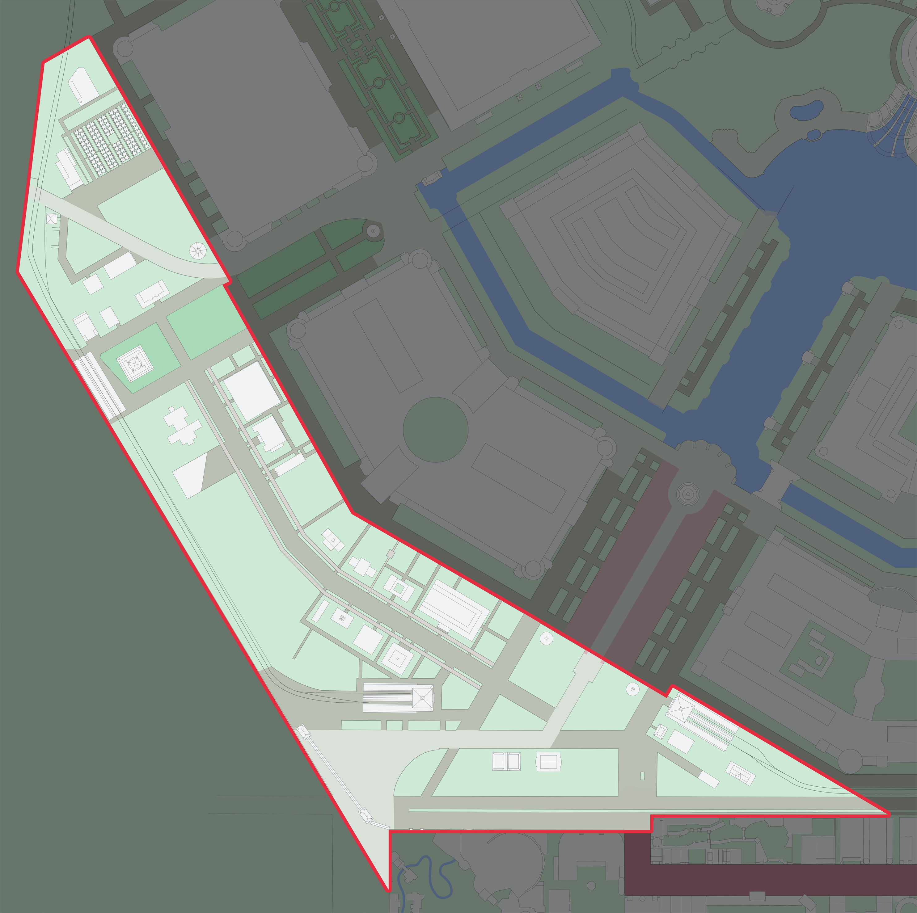
As one entered the Fair from the Lindell Street, the Model City was the first attraction you would see.
The Model City was a four-block area that showcased how an idea town could look like. This was an important attraction for city planners, officials as well as administrators and civilians. 1,200 feet of roadway featured ten different variations of paving. There were illuminated signs, water and sewer service, lamp posts, public clocks, fountains, as well as a miniature city park all to illustrate what can be done in a town.
National Cash Register as well as the Salvation Army both sponsored a building at the Model City.
Major cities including: New York, Atlantic City, Kansas City, and San Francisco had buildings along the street. The New York building alone cost $86,500 dollars to build, complete with a subway model, and numerous plans for bridges and tunnels.
 There was an elaborate model city at the fair.
